May 1, 1564. The mist clung heavily to the rolling hills of Yorkshire, the kind of dampness that permeates the bones and whispers of otherworldly legends amidst the heather.
The Lone Surveyor
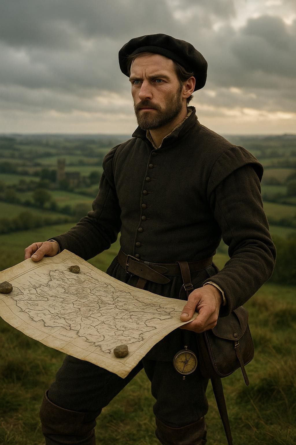
Into this mist walked a man unlike any other of his time, Christopher Saxton, a surveyor with an extraordinary ambition. Born in Dunningley, a small hamlet with humble roots, Saxton was armed not with weapons or armor but with compasses, measuring chains, and primitive drawing tools. In an era where few ventured beyond their birthplace, and where maps—if they existed—were more decorative than informative, Saxton embarked on a journey that would reshape the understanding of his homeland.
Saxton was commissioned by Thomas Seckford, a wealthy lawyer and statesman, who recognized the pressing need for accurate maps amidst rising trade, conflict, and exploration. The Tudor era was marked by significant political and social changes, including the consolidation of lands, the dissolution of monasteries, and ever-growing urban centers. Yet, despite England's burgeoning might, its rulers were effectively governing a nation they could not envision geographically.
Each day, Saxton walked alone, traversing the verdant ridges and secretive valleys of England and Wales. His feet paved paths across historic landmarks and uncharted rural expanses, ascending church towers to gain the clearest view of the surrounding lands. These structures, resilient sentinels of stone, offered the perfect vantage points to sketch the contours of the countryside—a painstaking task given the rudimentary tools at his disposal.
Undeterred by wind or rain, Saxton often hired local guides, not merely to mark paths avoided by conventional travelers but to delve into the tales and turns known only to those who lived within the land's embrace. His task was fraught with challenges, from this hostile terrain to skeptical locals, yet his vision remained unyielding. With each stroke of his pen, Saxton’s parchment brought the intangible into focus, gradually shaping a face of England that had remained invisible to its own people.
The Craft of Creation
By 1574, a decade after the journey began, Saxton's painstaking efforts bore fruit. The release of his comprehensive atlas titled *"Saxton’s Atlas of England and Wales"* was nothing short of revolutionary. It became the first true portrait of England and Wales, representing every county with remarkable precision, and remained unrivaled for decades. Saxton’s maps were not merely topographical; they were artistic treasures as well, embellished with intricate designs, ornate borders, and heraldic symbols that both honored and informed their viewer.
The meticulous craftsmanship of Saxton's work is evident in the intricate detail with which he captured the landscape, each county told a story of its own. His maps were more than just tools for navigation; they were a declaration of England's emerging national identity. These maps, like the country they depicted, were fiercely individualistic yet woven into a cohesive whole, reflecting the unique yet united tapestry of the Tudor realm.
The geographical accuracy of Saxton’s work allowed for a clearer understanding of regional politics, natural resources, and the strategic advantages of various landscapes. Beyond the academicians and statesmen of the time, Saxton's maps were also tools for merchants and explorers expanding their trade routes and horizons. They provided a clarity of the land that enabled better strategic planning, land division, and even military operations, as England's ambitions grew beyond its isle to the wider world.
A Vision for Posterity
The legacy of Christopher Saxton’s work is not merely the sum of ink on paper. It is the vision of an England explored by him alone long before highways and railways carved the land into parts. Saxton's maps heralded the dawn of a new relationship between the people and their territory, turning abstract land ownership into tangible reality and fostering a burgeoning sense of national identity.
As England’s story marched forward through the centuries, with the expansion of the British Empire and the rapid advancements of the Industrial Revolution, Saxton's achievement laid the foundational understanding of the very landscape that would sustain and propel these changes. His atlas went on to inspire cartographers and explorers who followed, establishing a tradition of precision that continues to underpin the art and science of mapmaking today.
Christopher Saxton, in defying the limitations of his era, not only gave the Tudor nation its first reliable face but also laid the groundwork for England's introspective look at itself as a cohesive entity. It was an endeavor both monumental and ephemeral, transforming the way people perceived and interacted with the world around them. His solitary paths through the mist-shrouded hills remind us how one man's unwavering vision can reveal truths hidden under our very feet. In tracing those ancestral lines with exactitude, Saxton etched a legacy that transcends the bounds of his invisible England, resonating still in the ways we see and understand our world.